Weathering/Erosion
Weathering and Erosion have contributed greatly to the formation of Zion National Park's Geological Features. 240 million years ago the area which Zion national park inhabits was a low lying basin just above sea level. As debris from the surrounding mountains accumulated it formed a pattern of deserts and shallow inland seas building up sediment. This process has accumulated 10,000 feet of sediment over the years. To see each layer of sedimentary rock and the history behind how each formed please see the Geological History page
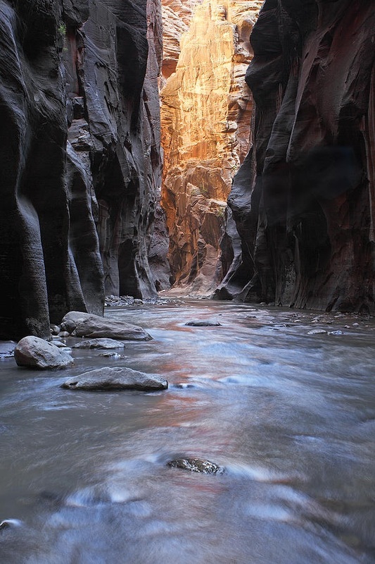
An example of the weathering/erosion in Zion Canyon. This particular area of the Canyon is known as the narrows.
|
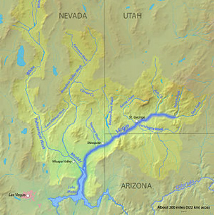
A map of the Virgin River, the river that eroded most of the Zion Canyon
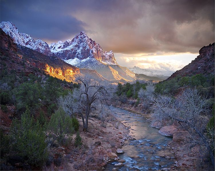
The Virgin River in Zion National Park
|
Uplift also aided erosion and weathering as it pushed large chunks of rock upward which gave runoff streams more speed thus allowing them to carry more sediment and eroding more rock. Eventually this created the narrow canyons that are present today in Zion. The Virgin river was a major product of this and created the narrow but beautiful Zion Canyon. The rivers and streams are still carrying sediment today and continue to make the canyons deeper and more spectacular.
Mass wasting is also in effect in the canyons as them rivers cut through the softer limestone and cause large chunks of the upper layers to fall down. This process is also called Canyon Widening.
Streams in the Zion area tend to take a rectangular path following jointing planes in the rocks. The Rivers and streams also have a high gradient because of uplift. The Virgin river has one of the steepest gradients in North America, ranging from 50 to 80 feet per mile. This high gradient is why the canyons are so deep and narrow.
Landslides can dam the river creating lakes in which lots of sediments are deposited. When the dam breaks it can leave a large basin covered in soil. Other than this there is not much soil which causes for rain to run down the canyon walls and gathering momentum which can cause severe flooding.
